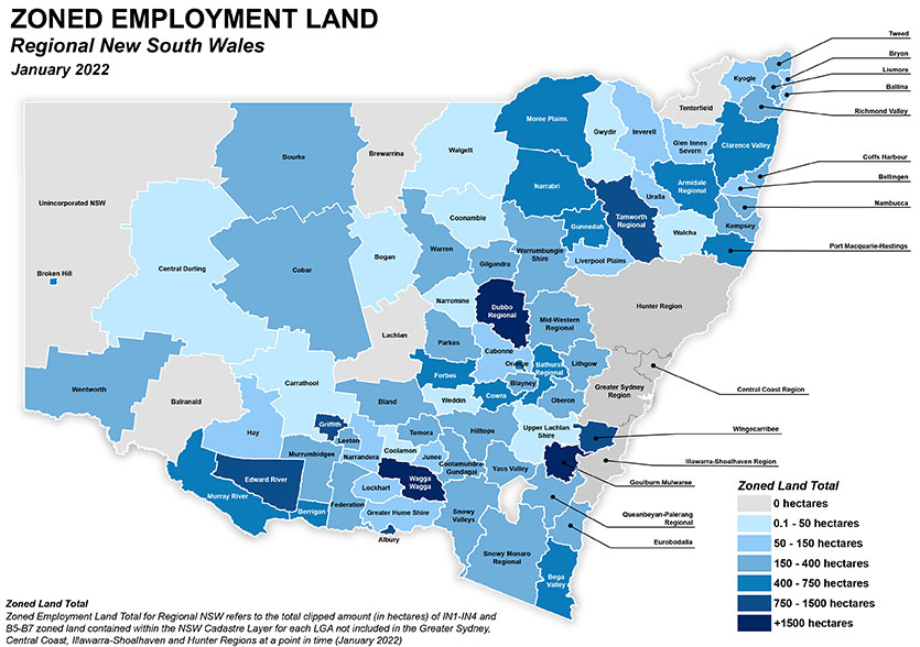
This map shows the total amount in hectares of zoned employment lands by Local Government Area for every LGA not already covered in the ELDM. The map is broken into seven total categories:
- 0 ha
- 0.1 – 50 ha
- 50 – 150 ha
- 150 – 400 ha
- 400 – 750 ha
- 750 – 1,500 ha
- +1,500 ha.
The LGAs with the largest zoned employment land area are:
- Goulburn Mulwaree
- Dubbo
- Wagga Wagga.
They are then followed by:
- Wingecarribee
- Griffith
- Albury
- Edward River
- Tamworth.
Of the regional LGAs, 43 fall in the middle categories of having between 150 and 750 ha of zoned employment land.
Four LGAs (Balranald, Brewarrina, Lachlan and Tenterfield) are identified as having 0 ha of zoned employment land.