Summary of key provisions
Low and mid-rise housing areas are residential zoned land within 800 metres walking distance from a mapped town centre or the entrance of a nominated station.
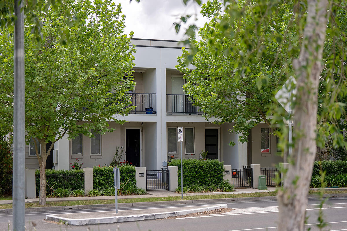
Unpacking low-rise housing
Low-rise housing is generally 1 to 2 storey, dual occupancy, multi-dwelling and manor houses. This form of housing contains 2 or more dwellings.
Central Barangaroo gets the tick of approval
Barangaroo has reached its next major milestone with the Minister for Planning and Public Spaces granting approval of the modification request for Central Barangaroo.

Housing Delivery Authority fast tracks 6,400 new homes
The Minister for Planning and Public Spaces has declared eleven housing proposals State Significant Development (SSD) creating capacity for 6,400 new well-located homes, following recommendations from the Housing Delivery Authority (HDA).
Low and Mid-Rise policy to unlock 112,000 homes in five years
The Minns Labor Government’s Low and Mid-Rise policy is set to deliver 112,000 homes across New South Wales over the next five years as the next stage of the policy comes into effect.
Broken Hill’s energy future secured by hi-tech air energy storage system
An old Broken Hill mine site will soon be transformed into a first-of-its-kind compressed air energy storage system, delivering energy security, jobs and investment to Broken Hill.
Housing Delivery Authority fast tracks 18 projects as State Significant Developments
The Minister for Planning and Public Spaces has declared a further 18 housing proposals State Significant Developments (SSDs) following the second round of recommendations from the Housing Delivery Authority.
Warrawong Plaza rezoned for 1,300 new homes
Warrawong is ready for an additional 1,300 well-located homes following the approval of new planning controls for Warrawong Plaza.
Up to 650 new homes for the Shoalhaven as part of plans for Nowra riverfront precinct
Two major housing projects in Nowra will be prioritised by the Minns Labor Government, in partnership with Shoalhaven City Council, to deliver up to 650 new homes.
Australia’s newest city starting to take shape
The Western Sydney Aerotropolis is set to take-off, with the official opening of the first building at Bradfield City Centre and the release of the Minns Labor Government’s infrastructure delivery plan which will drive further investment into the region.