Project proponents: City of Parramatta Council
Location: Parramatta River foreshore in Rydalmere. Parramatta local government area / Dharug Country
Coastal management area(s): Coastal wetlands and littoral rainforests area (CWLRA) – proximity area, coastal environment area and coastal use area
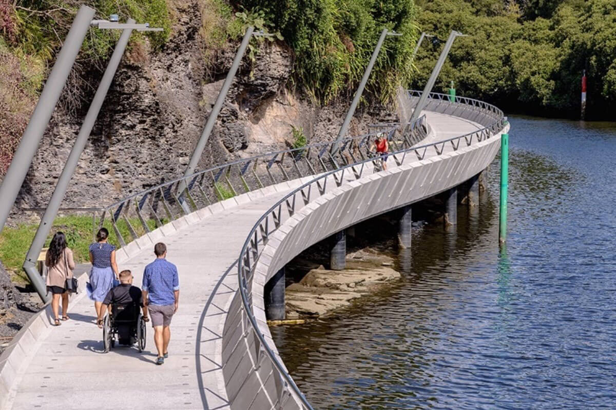
The Parramatta River Escarpment Boardwalk project gives pedestrians and cyclists foreshore access along a 500 m-long section of the Parramatta River near Parramatta River Wharf.
The boardwalk passes through areas of mangroves and near turpentine trees of local heritage significance. The boardwalk is at river level, so it was important to make it resilient to river flooding during high rainfall events.
Coastal Design Guidelines application
This case study shows how you can apply chapter 4.3 ‘Design guidance for the built environment’ from the NSW Coastal Design Guidelines 2023 (PDF, 9.2 MB).
Objectives
Objective 4.3.1: Use built form to reinforce the beauty and character of coastal places
The boardwalk follows the natural form of the riverbank. While it is raised in sections, the boardwalk does not dominate the foreshore or block views to and from the river.
Objective 4.3.2: Ensure connectivity to and between coastal places
The boardwalk links with existing access paths as part of the Parramatta Valley Cycleway. It completes a continuous walking and cycling path connecting public spaces and institutions along the Parramatta River foreshore. The walkway also links the Parramatta Wharf to residential areas and a local school by 2 new sets of stairs.
Objective 4.3.3: Ensure civic amenity and appropriate access to the coastal environment
The boardwalk gives pedestrians and cyclists access to the Parramatta River foreshore. The boardwalk is elevated over the river to reduce effects on mangroves in the project area.
Objective 4.3.4: Create spatial frameworks that are resilient to coastal hazards
The Escarpment Boardwalk allows for low-impact active transport, and passive recreational use. It establishes a functional spatial framework that gives the community access they would not otherwise have.
Objective 4.3.5: If the proposal will locate structures in areas affected by coastal and other natural hazards, ensure that they can be adapted, relocated and transformed
As the boardwalk is a foreshore access path that gives people access to a flood-prone river, it would be difficult for council to locate it away from natural hazard areas. The boardwalk has been designed to withstand high-velocity floodwaters, using pre-cast concrete panels.