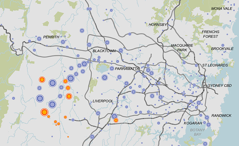
This map shows Zoned and Employment Land Precincts in the Greater Sydney Region. There are a number of very large precincts in the area of Western Sydney surrounding the site of the Western Sydney Airport. There are also many large to medium sized precincts in Western Sydney, surrounding Parramatta, Blacktown, Penrith, Liverpool and Campbelltown. There are fewer precincts in Sydney’s North, and these are smaller and much more dispersed. They surround Brookvale, Frenchs Forest, Hornsby and Mona Vale. There are many very small precincts clustered together in Sydney’s Inner West, and some medium sized precincts surrounding Randwick and Kogarah as well as at Kurnell.
This map also shows the Potential Future Employment Land Precincts of Greater Sydney, with all these precincts being located in Western Sydney. With the exception of one medium sized Future Precinct to the South-East of Liverpool, the remaining Future Precincts are all located to the West of Liverpool, dispersed between Penrith to the North and Campbelltown to the South.