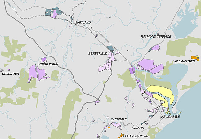
This map shows Zoned Employment Land Supply in the Greater Newcastle Region. There is a large amount of Special Purposes zoned land located at Newcastle Port. This is surrounded immediately south by many smaller clusters of industrial zoned lands. There is a large area of industrial zoned land to the north of Newcastle towards Raymond Terrace, as well as to the west near Beresfield, and further to the west at Kurri Kurri. West of Maitland, near Rutherford, is a large cluster of B5 zoned land. There are a number of smaller and more widely dispersed clusters of industrial and B7 zoned land following the railway line from Kotara, to Glendale and Morisset as well as along the Pacific Highway corridor in Gateshead, Bennetts Green and Belmont.