A plan for the Central Coast’s urban growth and environment.
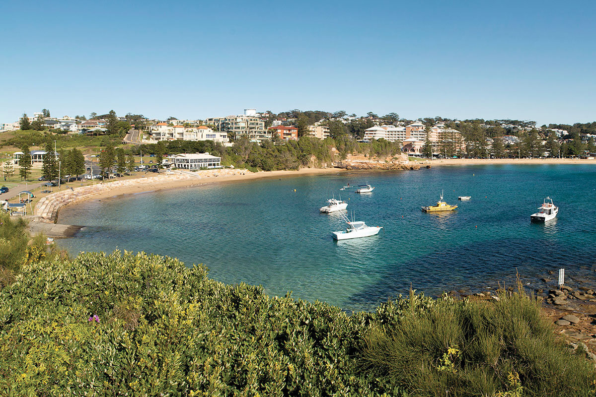
The Central Coast is a diverse and growing scenic region close to Sydney and the Hunter. It is recognised for its beautiful natural landscapes, vibrant communities, and rich heritage.
The NSW Government has released a draft plan for the area’s urban growth and environment – the Central Coast Strategic Conservation Plan.
The plan, now open for public consultation, aims to directly support around 14,000 new homes, 30,000 new jobs, and the Central Coast’s unique environment, over the next 30 years.
It will identify where development can and cannot occur, and which areas must be protected. The plan will:
- provide upfront biodiversity approvals for development on certified urban capable land
- make it easier and faster to build new homes and infrastructure
- provide planning and investment certainty for developers
- help protect the Central Coast’s unique environment into the future.
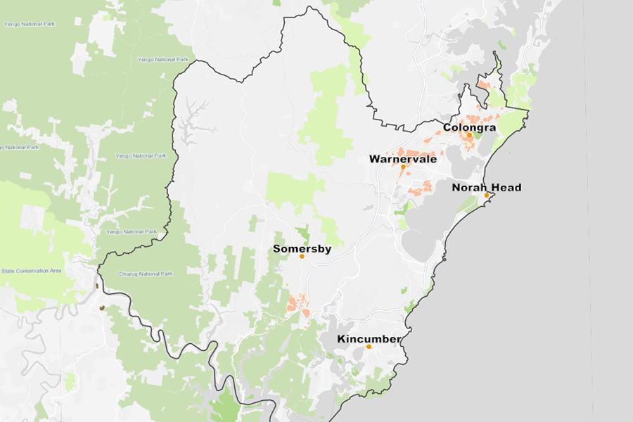
The plan is the next step in delivering the Central Coast Regional Plan 2041, unlocking land for development in precincts like Somersby, Greater Warnervale, and Greater Lake Munmorah.

Previous consultation on the terms of reference for the Central Coast Strategic Assessment
The NSW and Australian Governments finalised the Terms of Reference for the Strategic Assessment Report for the Central Coast Strategic Conservation Plan on 25 March 2025.
The terms of reference explain how the impacts of development on plants and animals protected under Commonwealth biodiversity law are assessed.
We exhibited the Central Coast Strategic Conservation Plan Draft Terms of Reference, from 15 November 2024 to 10 January 2025, under section 146(1B)(b)(ii) of the Act.
Frequently asked questions
The Central Coast Strategic Conservation Plan is a 30-year draft plan covering 3,069 hectares of land that will support the Central Coast’s urban growth and environment. The plan will enable development on certified urban capable land (certified land) while protecting the region’s unique native plants and animals. It identifies proposed areas that can be developed without further biodiversity approvals and land that is not suitable for more intensive development.
Currently open for public consultation, the plan will directly support around 14,000 new homes and 30,000 new jobs over the next 30 years, while protecting the Central Coast’s unique environment.
It will provide state and federal biodiversity approvals for development in the Greater Warnervale, Greater Lake Munmorah, and Somersby precincts.
The plan takes a strategic approach to locating new homes and infrastructure in areas where development can be maximised, while including a comprehensive conservation package to balance the impact on biodiversity.
The plan is needed to support urban growth on the Central Coast. As we develop more homes and critical infrastructure, we must protect our plants and animals. As the population increases, the plan will deliver much-needed housing in the area while contributing to healthier local communities and environments.
The plan is the next step in delivering the Central Coast Regional Plan 2041 and unlocking new lands to support the region’s growth. It provides investment certainty and streamlines the delivery of new housing, infrastructure, and jobs. It also supports the Department’s commitment to Aboriginal economic self-determination by supporting Darkinjung Local Aboriginal Land Council to activate its Aboriginal land.
The plan will secure vital habitat corridors and protect key biodiversity sites across the Central Coast through public and private land conservation and help reduce the impact of development on the environment.
It focuses on protecting habitat for locally important species including critically endangered orchids, the Swift Parrot, Regent Honeyeater, and unique local plants like the Somersby Mintbush and Charmhaven Apple.
The plan is currently on exhibition and proposes two land categories to guide the development process and provide the necessary biodiversity approvals. These land categories are:
- Certified urban capable land – will have upfront state and federal biodiversity approvals, through the plan. Landholders will not be required to seek their own biodiversity approvals if they want to develop their land. A landholder is still required to seek other relevant planning approvals before development, which will include mitigation measures to reduce the impacts on biodiversity.
- Non-certified land – is not suitable for more intensive development. Current land uses can continue, however native vegetation clearing will be restricted.
Some sections of the proposed certified urban capable land will need to be surveyed for four critically endangered plants, before any development applications can be assessed and determined. If these surveys apply to your land, you should have already received a letter from the Department offering to undertake these surveys free of charge.
Landholders in the non-certified land category, who want to develop their land, will still be able to submit development applications. However, planning controls are being proposed to minimise the impact to biodiversity, including that:
- development consent is needed for any proposals that involve clearing of native vegetation on non-certified land
- development controls are in place for non-certified land so that any development avoids, minimises, and offsets impacts to biodiversity
- rezoning of non-certified land is restricted, so that it will not lead to more intense development.
Accredited, independent ecologists have completed extensive surveys across 1,820 hectares (approximately 60%) of land that could be developed under the plan, to understand its biodiversity values and assess the impacts of development.
The surveys involved completing 327 Biodiversity Assessment Method (BAM) plots to determine the vegetation present. Surveys for detecting threatened species were completed over multiple survey seasons. They met NSW and Commonwealth survey and assessment guidelines, including the NSW Biodiversity Assessment Method (BAM) 2020.
The survey data and existing biodiversity information was used to prepare maps of native vegetation, threatened ecological communities and species habitat, for land with development potential and the broader Central Coast local government area.
The Department used this information about biodiversity values, along with socio-economic values like development potential and regional planning objectives, to define the plan’s proposed land categories: certified urban capable land, and non-certified land. The criteria applied is described further in Appendix C: Avoidance planning criteria of the draft plan.
Further surveys are underway in areas of potential habitat for four critically endangered plant species that were not included in the previous round of surveys. If these current surveys apply to your land, you would have already received a letter from the Department offering to undertake them for you, free of charge.
The Department is proposing planning controls to put the plan into action under the NSW planning system. These changes will mainly come into effect through amendments to Chapter 13 (Strategic Conservation Planning) of State Environmental Planning Policy (Biodiversity and Conservation) 2021 (BC SEPP). Additional controls are proposed through a new direction for any rezoning of non-certified land under s 9.1 of the Environmental Planning and Assessment Act 1979, and the development of guidelines to manage indirect and prescribe impacts from development.
The proposed amendments aim to support the delivery of development in the Central Coast in a way that continues to ensure adverse impacts to important biodiversity are avoided, minimised and mitigated, consistent with state and federal biodiversity approvals. These include to:
- facilitate appropriate development in the biodiversity certified area (the proposed ‘certified urban capable land’) including by identifying that land on a map
- identify land that is not certified for development to protect existing areas of high-value biodiversity (the proposed ‘non-certified land’)
- minimise impacts from development on biodiversity values on non-certified land through the application of planning controls to restrict native vegetation clearing and to limit how non-certified land can be rezoned
- mitigate indirect and downstream impacts from development on sensitive biodiversity values on land adjacent to the certified urban capable land
- protect four critically endangered plant species by requiring pre-development surveys and restrict development if one or more of those species is found
- guide infrastructure activities, including essential infrastructure, to meet the avoid, mitigate and offset outcomes for the plan.
Detailed information on the planning controls can be found in the Explanation of Intended Effects, which is being exhibited with the plan.
If you have an existing development application (DA) or planning proposal and therefore have or are securing an alternative pathway for biodiversity approvals, you can request that the Department consider removing this site from the plan's mapping.
The Department’s decision of this will depend on the following considerations:
- whether the development application is approved, and that the consent has not expired
- the stage of the planning proposal and whether it is supported by a BCAR and the stage of the BCAR preparation
- the nature and extent of the development consent or planning proposal, including the possible biodiversity impacts
- any other relevant considerations.
In order for this to be considered, you must notify the Department by at least the close of business on the final day of public exhibition (Friday 14 November).
If the consent authority determines the development application before the State environmental planning policy giving effect to the draft plan comes into effect, the consent authority will decide how much weight to give the draft plan when determining the development application.
If you lodge your development application before the State environmental planning policy giving effect to the draft plan comes into effect but the consent authority will determine the development application after the State environmental planning policy giving effect to the draft plan comes into effect, the strategic biodiversity component (SBC) levy will apply to new residential, commercial or industrial development in certified land in your application. For more information, read the SBC factsheet.
The draft Plan was on public exhibition from Tuesday 30 September to 5pm on Friday 14 November 2025.
All feedback received will be considered before the final Plan is submitted to the State and Federal Environment Ministers for consideration and approval, and before the planning controls are finalised and come into effect.
A report explaining how the Department considered public feedback on the draft Plan, and its supporting documents, will be released with the final Plan in 2026.
Related information
More information
If you have any questions, email the team at [email protected]