Connections to Country
Aboriginal culture is considered one of the oldest surviving cultures in the world. Connection to Country, or the sacred link between Aboriginal people and the land and waterways throughout Australia, is both a physical and a deeply spiritual connection. The Central Coast is part of an intricate network of Aboriginal cultural heritage sites and places, connected by Aboriginal walking trails, routes and dreaming tracks. These sites are connected and form part of a complex Aboriginal cultural landscape in the region.
The Central Coast region is home to the Darkinyung people. On the Central Coast, there is evidence of seasonal migration that Aboriginal people used before colonisation, cyclical movement within and between vast regional landscapes ensured sustainable food gathering practices and allowed Aboriginal people to connect to Country and practice culture. Individuals or whole tribes might travel vast distances to attend corroborees and ceremonial events. Along these well-travelled seasonal corridors were significant places that were sacred to either women or men or otherwise culturally significant at a regional level.
On the Central Coast, these places could be the mountains, rivers, lakes, lagoons, valleys, wetlands or beaches, which all have a deeply spiritual connection to the Dreaming or Creation.
The complex and dynamic relationships that characterise Country mean that making a connection with Country is not a task that will ever be completed, but rather an ongoing commitment to pay attention and to evolve our understanding – before, during, and beyond the time frame of a single project life cycle.
The regional plan will also support the Central Coast’s Aboriginal community to enjoy equal access to local economic, employment and education opportunities.
It considers new pathways to promote economic self-determination, more meaningfully recognise and respect Traditional Custodians, create true connections to Country and integrate Aboriginal cultural knowledge and practice into urban design and planning.
Specifically, it sets the ambition for the Darkinjung Local Aboriginal Land Council (LALC) to leverage its Aboriginal land so that Aboriginal people can determine their own economic, cultural and social outcomes. This is detailed in objective 2 (PDF, 11.5 MB) of the regional plan.
The regional plan will help Darkinjung LALC to pursue its development and conservation aspirations, as outlined in their community land and business plan and development delivery plan. The NSW Government will accelerate the assessment of Darkinjung LALC planning proposals that:
- Are identified in the Darkinjung Development Delivery Plan.
- Has been the subject of pre-lodgement agency consultation.
- Has adequately addressed any relevant site-specific considerations.
The regional plan and supporting district planning priorities align with Darkinjung LALC’s social, cultural, environmental and economic aspirations.
Social connections
The regional plan introduces the concept of the 15-minute neighbourhood. Read objective 3 (PDF, 11.5 MB), objective 4 (PDF, 11.5 MB) and objective 5 (PDF, 11.5 MB) for more detail.
This will allow more people to access everyday needs for a fulfilling lifestyle closer to where they live. It means a greater diversity of housing and capitalising on the existing and emerging industries that will power a sustainable future for the Central Coast.
The concept recognises that the Central Coast – which generally features low density, separated land uses and car-prioritising infrastructure – has consequences in terms of costs, equity and choice.
If we can reduce car dependency and vehicle ownership, we can reduce:
- household costs
- public health and infrastructure costs
- greenhouse gas emissions and air pollutants
- environmental impacts
- social inequity and health issues.
We know that in rural areas, it is unlikely people will access local needs on foot or bike. The regional plan aims for people to be able to access most needs within a 30-minute drive to a strategic centre.
This allows for reasonably easy travel across communities, potentially on foot, by bike or on public transport. It requires better public transport services between key destinations.
The idea of the 90-minute region connects the Central Coast City to the Eastern Harbour City, Central River City, Western Parkland City, Lower Hunter and Greater Newcastle City and the Illawarra-Shoalhaven City. Fast rail is essential to this vision.
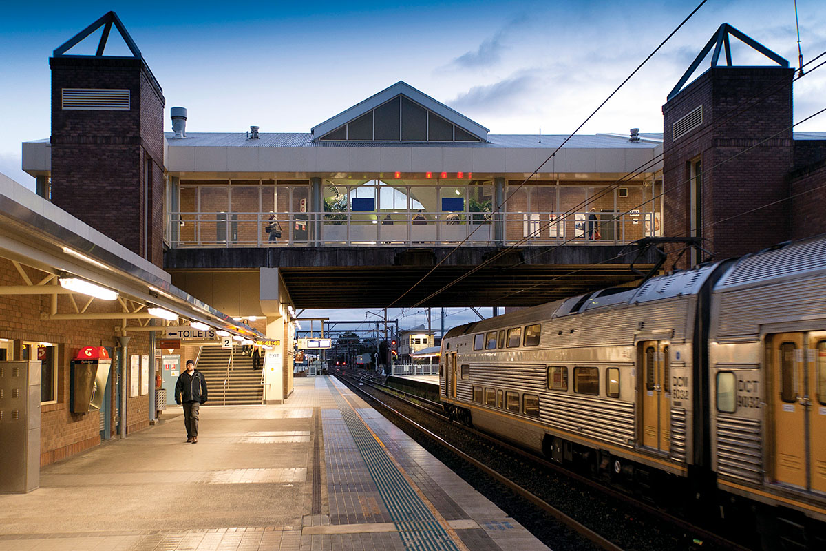
Public transport, streets and places
With more people living in urban areas, safe, reliable and frequent public transport will make it easier for people to access open spaces, shops, cafes, child care, affordable housing and arts and cultural spaces.
While the north-south rail connection services the western edge of the coast’s urban area, east-west public transport connections will encourage people to choose sustainable options to travel from the coast to employment and other activity centres such as Gosford, Tuggerah and Wyong.
More people will walk or ride if they can:
- access well designed streets, paths and public spaces separated from traffic
- use continuous footpaths on both sides of the road
- enjoy barrier-free access to public transport and services
- move easily between urbanised and more natural areas.
This includes school-aged children who could walk or cycle to school and other activities, such as sport and hobbies.
For decades, the Central Coast’s streets have been designed for cars rather than people. Transforming streets for people will require a new approach to urban design and coordinated effort across governments, community and industry.
Read objective 3 (PDF, 11.5 MB), objective 4 (PDF, 11.5 MB) to find out more.
Major transport connections
The vision for One Central Coast is about communities that are:
- physically connected by infrastructure
- socially connected through relationships and a shared sense of unity in 15-minute neighbourhoods
- always connected to Country.
The Central Coast is both halfway between Sydney and Newcastle, and between Brisbane and Melbourne. The M1 Pacific Motorway connects people and places, with major interchanges are at Somersby, Ourimbah, Tuggerah and Warnervale. View map of the key transport corridors (PDF, 2.1 MB).
Investment in NorthConnex and widening of the M1 Pacific Motorway will better connect the Central Coast with Greater Sydney and the Western Parkland City. The regional plan will be complemented by the Central Coast Regional Transport Plan.
From a land and transport planning perspective, the regional plan focuses on:
- traffic congestion
- the separation of home and work locations
- emissions and noise pollution
- vulnerability to climate change.
These issues originate, in part, from the land development patterns and transport investment decisions focused on cars. Reducing car dependence while maintaining easy access to destinations will benefit individual travellers and the region as a whole. Focusing development around key activity centres and transit corridors will increase the viability of improved public transport services along key transport corridors that connect each centre. Read objective 4 (PDF, 11.5 MB) of the regional plan to find out more.
Download the Central Coast Regional Plan 2041 (PDF, 11.5 MB).
Fast rail
A fast rail corridor from Sydney to Newcastle will influence the future prosperity of the Central Coast. It could reduce travel times to give people more choice about where they live and work. It could also provide a catalyst to attract investment, create jobs and support key industries.
Fast rail stations could allow for new placemaking in centres and along the corridor. Station precincts and their surroundings would benefit from development and business investment.
Find out more in objective 4 (PDF, 11.5 MB) of the regional plan.
Freight
The Central Coast is part of an integrated global logistics system. Businesses have direct motorway connections to ports at Newcastle and Botany Bay, and international airports at Newcastle, Sydney Kingsford Smith and Western Sydney.
Efficient freight movements allow Central Coast business and industry to access local markets and beyond, particularly the agricultural and extractive resource sectors mainly located west of the M1 Pacific Motorway.
Read objective 4 (PDF, 11.5 MB) of the regional plan to find out more.
Council’s cycle infrastructure focus areas
Council’s priority cycling connections to activity centres, public transport, schools/education facilities, between centres and for recreational and tourism will focus on:
- connections within 5 km of Gosford, Ourimbah TAFE and University of Newcastle campus
- Gosford to Tuggerah/Wyong
- the southern shores of Lake Macquarie, Lake Munmorah, Budgewoi Lake and Tuggerah Lake
- Lake Munmorah to Ettalong tourist route
- Woy Woy to Warnervale
- Kariong to Terrigal
- two signature projects: Gosford to Point Clare Railway Shared Path and Magenta Shared Path (The Entrance to Toukley).