Have your say on the future of Appin (Part) Precinct
A draft Development Control Plan and draft Precinct Structure Plan prepared by Walker Corporation were available for public feedback from Monday 8 September to Monday 6 October 2025.
The draft plans outline how future development applications will be assessed and will shape how the area grows.
The draft Precinct Structure Plan shows where homes, shops, parks, conservation areas, and infrastructure could go.
The draft Development Control Plan outlines proposed planning controls that will apply to homes, subdivisions and non-residential development. These plans must be in place before development can proceed.
The plans are supported by a Transport Management and Accessibility Plan prepared by Walker Corporation and conditionally endorsed by Transport for NSW.
The NSW Government is committed to increasing housing supply and affordability, helping more people find a place to call home in well-connected communities.
The Department of Planning, Housing and Infrastructure (the Department) is responsible for exhibiting the draft plans, gathering feedback, and assessing the final plans.
Concurrent exhibitions
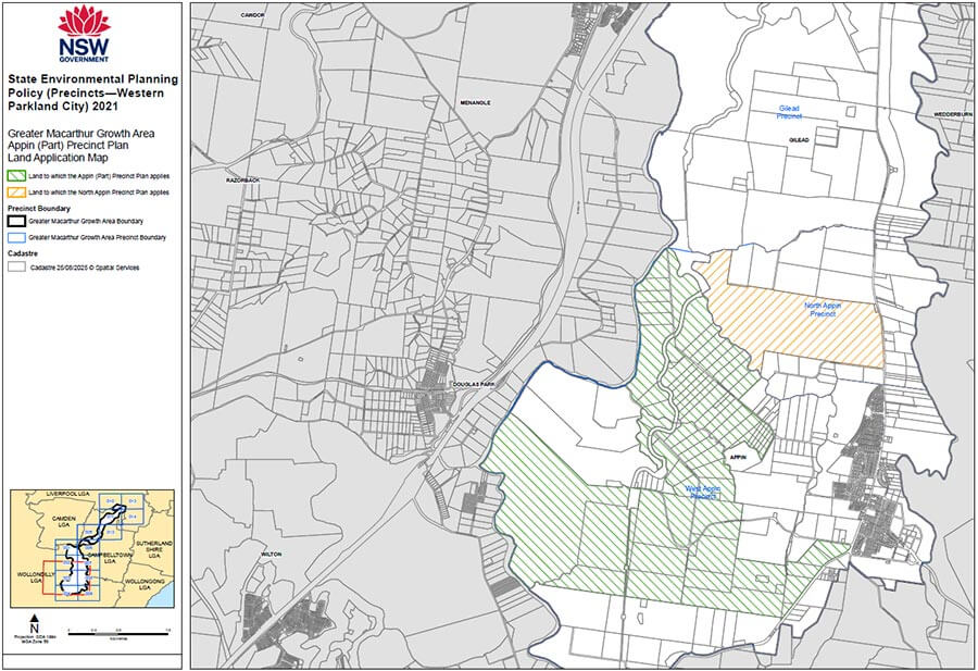
Plans for the North Appin Precinct were exhibited concurrently with the Appin (Part) Precinct plans. This includes the Planning Proposal seeking to rezone the land, draft Development Control Plan and draft Precinct Structure Plan as prepared by the Ingham Property Group. This ensured that all relevant information for the 2 large projects in the Appin area was available at the same time.
Information session
A face-to-face community drop-in session was held on Tuesday 23 September 2025, from 4 to 6:30 pm.
What happens next
The Department will review feedback on the exhibition. Walker Corporation will respond to the feedback when preparing the final plans for consideration by the Planning Secretary. If the plans are approved, development applications can be lodged, subject to infrastructure requirements.
A State Planning Agreement will also need to be prepared to deliver infrastructure to support the new homes.
Email the Southern Western and Macarthur team at [email protected]
What is planned for Appin (Part) Precinct
The Appin (Part) Precinct was rezoned on 15 December 2023. Find out more about the Appin (Part) Precinct rezoning on the NSW Planning Portal.
The 1,378 ha precinct will provide up to 12,900 new homes, including affordable housing, along with open space and local centres, including shops and services.
About 470 hectares have been protected under an environmental conservation zone to help secure new koala corridors.
Development in the precinct will roll out over several years by Walker Corporation. A development staging plan has been prepared to identify how these stages will occur and what development is included, such as the number of dwellings, local centres, land dedication, infrastructure, and amenity to be delivered.
Schools and emergency service facilities will be built in later stages as the population grows in the area. Funding for infrastructure has been committed to deliver the early stages of development.
Although land has been rezoned, development cannot occur until a Precinct Structure Plan and a Development Control Plan are finalised for the land.
Frequently asked questions
Significant investment is needed to upgrade regional wastewater and transport networks to support new housing in the Greater Macarthur Growth Area. Planning must ensure key infrastructure, like wastewater and roads, is delivered alongside new homes.
The NSW Government has identified that 2,499 new homes can proceed in the Appin (Part) Precinct and North Appin Precinct, based on existing infrastructure and developer-funded upgrades. This dwelling cap ensures homes aren’t released without the necessary infrastructure or agreed funding. It includes triggers for delivering wastewater and road upgrades.
The cap will only increase when additional infrastructure capacity becomes available. Staging land releases in step with infrastructure delivery is key to managing sustainable growth.
The Department is working closely with Sydney Water, NSW Government agencies, councils, and the developers to ensure reliable water services are in place before homes are built. This includes exploring interim and long-term wastewater solutions, which may be accelerated by developers or private providers.
Walker Corporation's draft plans for the Appin (Part) Precinct include:
- three new local centres, including shops and services, sporting fields and open space
- new transport corridors and road upgrades, including the construction of new intersections along Appin Road near Appin township
- sites for future emergency service facilities, including NSW Fire and Rescue, NSW Ambulance, NSW Police, as well as 3 new school sites.
Infrastructure will be delivered in stages, as outlined in the development staging plan. Roads and open space will come early, with schools and emergency services added as the population grows. Funding is already committed for the early stages.
Walker worked with Transport for NSW and the Department to prepare a Transport Management and Accessibility Plan for the Appin (Part) Precinct to provide an overarching framework for the implementation of essential transport infrastructure and services to support development.
The final Transport Management and Accessibility Plan was conditionally endorsed by Transport for NSW on 1 May 2024. Walker Corporation then used the Transport Management and Accessibility Plan findings to inform the draft Development Control Plan and draft Precinct Structure Plan.
When the land was rezoned in December 2023, approximately 470 ha of land in the Appin (Part) Precinct was protected as an environmental conservation zone. The rezoning also secured a substantial part of the Nepean River Koala Corridor and the Ousedale Creek Koala Corridor. The Ousedale Creek corridor provides an east-west link for koalas and other fauna populations from the Georges River in the east to the Nepean River in the west.
The koala corridors are also mapped to clearly identify land set aside to protect and increase koala habitat. Development consent for any development in a koala corridor will be subject to an assessment process, which includes obtaining the Planning Secretary’s concurrence and addressing the LEP provisions. The controls also only allow appropriate development, with roads and buildings prohibited and the list of permissible uses implementing the Office of the Chief Scientist and Engineer’s advice.
Significant areas of existing vegetation will be conserved with cleared former grazing land to be restored and revegetated.
The rezoning is consistent with and is an important step in implementing the Cumberland Plain Conservation Plan and the recommendations of the Office of the Chief Scientist and Engineer.
The draft Development Control Plan and draft Precinct Structure Plan on public exhibition continue to support the implementation of the environmental conservation zone and koala corridors through detailed planning controls.