Located in Sydney’s West, the Western Sydney Employment Area includes a number of precincts.
Development in each precinct will help create future employment and growth in the area.
Development is governed by the State Environmental Planning Policy (Western Sydney Employment Area) 2009.
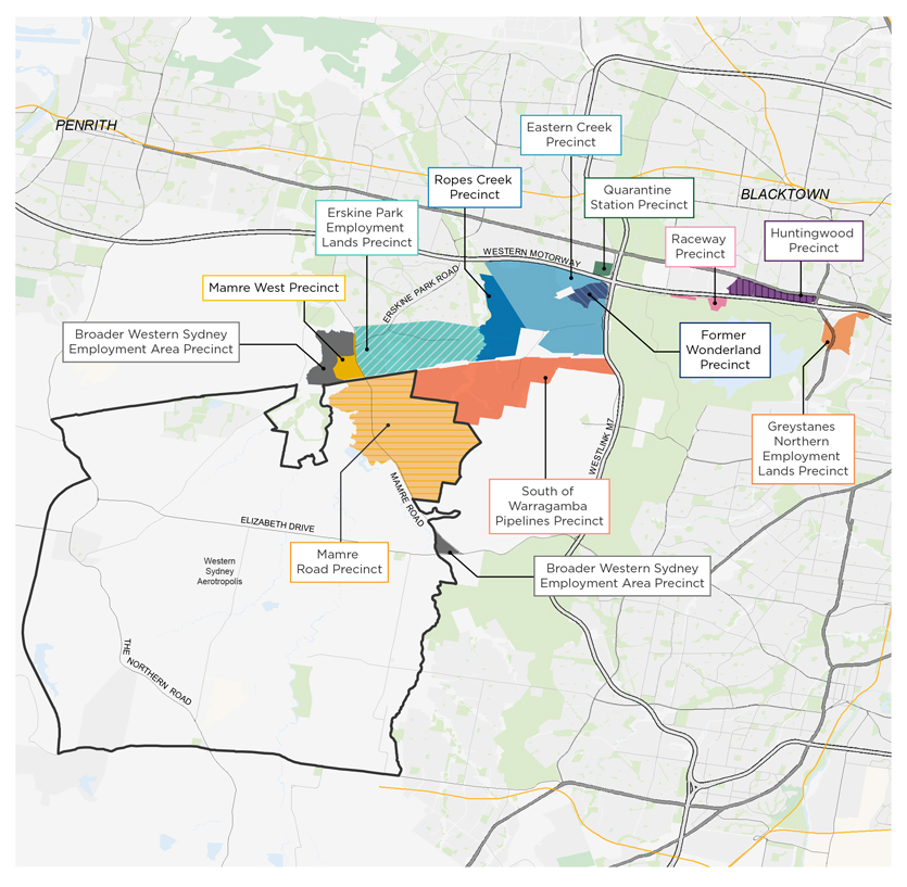
Rezoned precincts in the Western Sydney Employment Area
- Eastern Creek
- Erskine Park Employment Lands
- Former Wonderland
- Greystanes Northern Employment Lands
- Huntingwood
- Mamre Road Precinct
- Mamre West (rezoned in June 2016)
- Quarantine Station
- Raceway
- Ropes Creek
- South of Warragamba Pipelines
Relationship with Western Sydney (Nancy-Bird Walton) International Airport
In 2014 it was announced the new Western Sydney International Airport would be based at Badgerys Creek.
The new airport will transform Western Sydney and bring even more job opportunities and growth to the Western Sydney Employment Area.
To account for the growth the airport will bring, the Western Sydney Employment Area boundary was extended to include land north of the airport but did not involve rezoning of land.
Planning for the Western Sydney Airport is now being investigated as a growth area. In August 2018, the Western Sydney Aerotropolis Stage 1 Land Use and Infrastructure Implementation Plan was exhibited and incorporated the area known as the broader Western Sydney Employment Area.
The Western Sydney Planning Partnership (Planning Partnership) has the responsibility for delivering the Final Plan and Precinct Plans within the Western Sydney Aerotropolis.
On 6 December 2019, the Planning Partnership released the Western Sydney Aerotropolis Planning Package.