West Schofields precinct is in Sydney’s North West Growth Area, about 10 km from the Blacktown CBD.
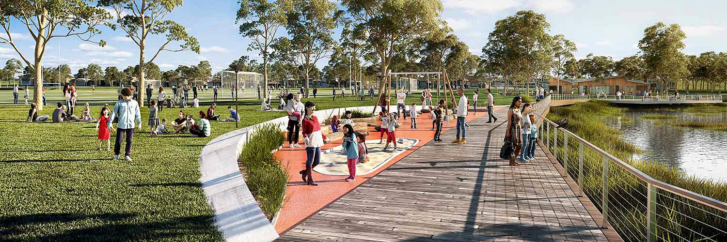
West Schofields will be a well-planned, connected and inclusive community offering a mix of housing close to jobs, transport, open space and essential services. With a commitment to improving flood resilience and preserving the natural landscape, the precinct will create a sustainable and liveable environment for current and future residents.
The rezoning proposal, explanation of intended effect, and accompanying documents were exhibited from 17 November 2025 to 30 January 2026 on the NSW Planning Portal. We hosted 4 community information sessions during exhibition and thank the community and other stakeholders who attended a session or made a submission.
Highlights of the draft proposal
The draft proposal will enable:
- approximately 2,900 homes on land that is less impacted by flooding, providing a range of housing options
- almost 170 hectares of open space to service the precinct and the surrounding areas
- new shopping and dining areas on Meadow Road with businesses and light industrial on South Street
- inclusion of cultural values and connections to Country
- over 60 hectares set aside for environmental conservation and protection of riparian corridors
- improved transport connections, including roads, cycleways and pedestrian pathways.
What happens next
We are considering the submissions received during exhibition to inform to the finalisation of the rezoning proposal and will prepare a finalisation report.
Read the proposal and frequently asked questions on the NSW Planning Portal.
The proposal is expected to be finalised in 2026.
-
Late 2025
Public exhibition
-
Early 2026
Analysis of submissions received
-
2026
Finalisation
What has happened
The Department of Planning, Housing and Infrastructure (the Department) publicly exhibited a draft precinct plan for West Schofields in 2018 proposing up to 4,500 new homes. Following exhibition, major flooding occurred across north-west Sydney.
The 2022 NSW Flood Inquiry was established to review the outcomes of recent flood events and made several recommendations regarding future development in the Hawkesbury-Nepean Valley. The Department’s Flood Advisory Panel (the Panel) considered these recommendations, along with high-risk rezonings such as West Schofields, and found that flood risk in West Schofields may be greater than previously known.
In 2023, the Department announced that the draft precinct plan for West Schofields should not proceed. Read the 2018 draft precinct plan finalisation documents on the NSW Planning Portal.
In September 2024, work started on a new rezoning proposal for the West Schofields precinct that considers new flood studies and guidelines as well as evacuation in case of major flooding. This revised proposal was exhibited from November 2025 to January 2026.
Subscribe to receive project updates
More information
For more information about the West Schofields precinct, email [email protected]