The vision
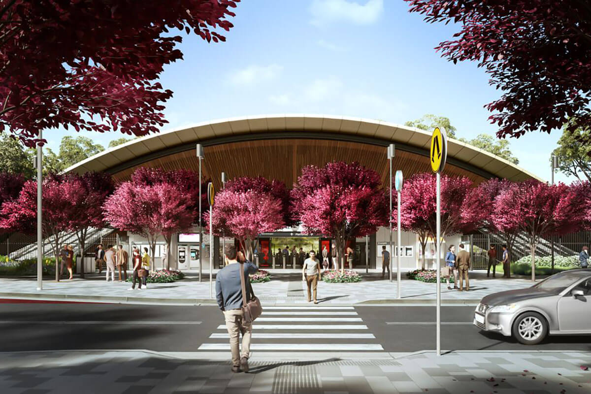
Cherrybrook Precinct will be transformed into a well-connected and walkable urban community located within a 10-minute walk of the metro station. The precinct will feature a vibrant town centre adjacent to the station with the creation of retail spaces and amenities including cafes, shops, and community and library facilities, that meet the needs of commuters and locals alike.
Recreation areas and public spaces will be a social hotspot for residents, while preserving the leafy character of the area. New apartments near the local centre will offer housing diversity and affordability for a growing population who will benefit from having easy access to public transport.


What’s happening now
A rezoning proposal for the Cherrybrook Precinct was available for public feedback between 7 November and 5 December 2025 and has now been finalised.
Visit the NSW Planning Portal for more information on the finalisation and amendments made since exhibition.
What has happened
Cherrybrook Precinct Rezoning Proposal
The Cherrybrook Precinct Rezoning Proposal provides a vision for a well-connected and walkable urban community that is characterised by 'green neighbourhoods', with increased tree canopy coverage to retain the leafy quality of the area.
New walking and cycling connections will make it easier to move around the precinct and access the Cherrybrook metro station, while new local parks will be delivered in each green neighbourhood. View the Cherrybrook Station Precinct map (PDF, 3.4 MB).
Highlights of the Cherrybrook Precinct Rezoning Proposal include:
- The rezoning proposal provides total development capacity for almost 10,000 new homes within walking distance of the metro station.
- 5% affordable rental housing, rising to 10% in the town centre.
- 4.6 hectares of new public open spaces across 5 new local parks.
- Preservation of the ecologically threatened Blue Gum High Forest by incorporating the forest into new areas of public open space.
- A natural transition of building heights from the town centre to adjoining residential neighbourhoods. This includes a maximum of 27 storeys in the town centre with a gradual reduction to 6 storeys on the edge of the precinct.
Visit the NSW Planning Portal for more information.
Cherrybrook Precinct Place Strategy
The Cherrybrook Precinct Place Strategy was finalised in December 2022.
The place strategy is a 20-year vision to enhance Cherrybrook’s leafy bushland residential character with new open space, new homes, more street trees and better access for pedestrians and cyclists.
The land previously owned by Sydney Metro located next to Cherrybrook Metro Station was rezoned in December 2022.
These plans were taken into consideration in preparing the Cherrybrook Precinct Rezoning Proposal.
You can view the final Place Strategy and supporting documents on the NSW Planning Portal and at Landcom.
What’s changed since the exhibition
The Department carefully reviewed all feedback received during exhibition and revised the proposal. Key changes include:
- The total number of new homes has increased from 9,350 to approximately 10,000 by increasing density and height on sites closest to the Cherrybrook Metro Station and on sites with the lowest densities.
- The minimum lot size has been increased from 2,500 to 4,000 square metres within the Hills LGA to enable landslip mitigation at a larger scale.
- Local road layouts and pedestrian links have been improved by reducing the number of new roads, widening those proposed, and increasing through site links to improve the active transport network.
- An expansion of existing Robert Road Park is now proposed.
- Provisions for a new primary school beyond 2041.
What happens next
Amendments have now been made to the Hornsby Local Environmental Plan 2013 (LEP) and The Hills Local Environmental Plan 2019 and new planning controls are now in effect.
Development Applications (DA) can now be lodged to assess development in accordance with these new controls. Any existing DAs will be assessed based on controls in effect at the time of lodgement.
Frequently asked questions
Since finalising the Place Strategy, the NSW Government has implemented several planning reforms aimed at increasing the delivery of new and diverse homes in well-located areas with access to existing public transport infrastructure.
The Cherrybrook Precinct’s proximity to the metro station positions it as a suitable location for increased housing to help address the housing crisis facing NSW.
Traffic and transport studies have been undertaken that confirm the precinct can support the increase in homes outlined in the rezoning proposal. You can read more information in the Traffic and Transport Study available on the NSW Planning Portal.
There are multiple properties subject to community title ownership schemes located within the Hornsby LGA section of the Cherrybrook Precinct.
Where new planning controls are proposed for properties subject to community title ownership schemes, 100% of landowners within each scheme would need to agree to amalgamate their properties to enable redevelopment to occur.
Generally, the requirements of community title schemes can make redevelopment more difficult compared to free-hold properties.
Rates are levied based on land valuations supplied by the NSW Valuer General to councils. Land values are determined on 1 July each year in line with the Valuation of Land Act 1916. They are provided to councils at least once every 3 years for rating purposes and to Revenue NSW every year for land tax purposes.
Property sales are the most important factor valuers consider when determining land values. In areas where a rezoning has occurred, or is proposed, there may be changes to property sale prices which is then reflected in land values.
It is important to note that regardless of changes in land valuations, the total amount of rates income a council may levy is limited by rate pegging determined by the Independent Pricing and Regulatory Tribunal (IPART).
We are proposing mandatory affordable housing contributions of:
- 5% affordable rental housing in the precinct
- 10% affordable rental housing in the town centre.
The rates have been identified to maximise public benefit and ensure development can occur and could result in up to 565 new affordable homes within the precinct.
New residential development such as residential flat buildings or terraces that result in at least 200 m2 of additional floor space may be required to contribute to affordable housing at the prescribed rates. This contribution will not proposed to apply to dwelling houses or dual occupancies.
In consultation with Hornsby and The Hills Councils, the Department is finalising section 7.12 Contributions Plans to ensure funding of local infrastructure supporting the growth proposed by this rezoning proposal. The local infrastructure funding is supplemented by the dedication of land for local parks, local roads and pedestrian links through development incentive provisions.
State and regional infrastructure to support growth of the Cherrybrook Station Precinct will be funded through the Housing and Productivity Contribution (HPC) fund.
You can view the draft infrastructure schedule on the NSW Planning Portal.
Since public exhibition, the Department of Education has reviewed the expected population growth and school capacity and advised that in the short term, potential upgrades to existing schools can be progressed over time to support the demand, with a provision for a new primary school beyond 2041.
More broadly, the NSW Government has committed over $1 billion in new school infrastructure across north-west Sydney, including 2 new high schools, 6 new primary schools and 12 new preschools, to support additional housing growth in this region.
The NSW and Australian Governments have committed $910 million to a new Rouse Hill Hospital, which will include an emergency department and birthing services, to cater to the growing needs of the north-west Sydney community.
The Department will collaborate with other government agencies to provide infrastructure and services to meet demand generated by development in the precinct.
A new library and community facility will be located within the town centre next to the Cherrybrook metro station. This facility of at least 3,000 m2 will support the expected population growth resulting from the rezoning proposal whilst also providing a new facility for the surrounding area.
New playing fields are proposed to support the community as part of this rezoning proposal. This includes fields located within both The Hills Local Government Area and Hornsby Local Government Area. We have been working with both councils to identify suitable locations for these facilities within the area. Funding for these facilities will be collected through contribution plans that are required for new development within the precinct.
The proximity of the metro station, new pedestrian and cycle links, and local road upgrades proposed will encourage greater walkability, active transport and public transport use within the precinct.
Detailed traffic modelling has been undertaken to determine the additional car use expected from new homes. This analysis recommends potential upgrades to major road intersections that may be funded through the Housing and Productivity Contribution scheme and other state infrastructure funding sources to support growth in the precinct. You can find more information in the Traffic and Transport Study available on the NSW Planning Portal.
New developments will be required to include onsite car parking in accordance with local requirements. Local councils will remain responsible for on-street parking strategies to achieve the best outcomes for the community.
Approximately 6 km of new walkable streets, cycle and bike paths are proposed to improve accessibility to the town centre and metro station, and the new open space network. The proposed routes for these links will cut across slopes to enable comfortable and accessible movement throughout the precinct and reduce unnecessary car trips.
Cherrybrook Metro Station is currently serviced by bus routes which provide direct connections from the Cherrybrook area including Pennant Hills and West Pennant Hills. As the area around the station develops, Transport for NSW will continue to monitor and review demand and examine ways to enhance the local bus network to make it easier for customers to get around.
Small sections of a limited number of properties are proposed to be acquired to enable road widening works and new intersection upgrades. Impacted properties are indicated on the Land Reservation Acquisition map and will be acquired over time as development in the precinct progresses.
Expected timeframes will be scheduled in the local contribution plans being prepared for both The Hills Shire Council and the Hornsby Shire Council areas of the Cherrybrook Precinct.
Any land required for the remaining new local roads and intersections and new local open space within the precinct will be delivered as development occurs. This public infrastructure will be delivered through land dedications where developers provide infrastructure in exchange for access to incentive planning provisions such as increased height and floor space ratio controls.
To achieve the desired outcomes of the master plan, the rezoning proposal establishes land consolidation patterns to form ‘key sites’ which are a requirement to achieve the incentive building height and density controls.
Key sites have been planned and appropriately sized with a level of density and building height distribution to deliver on key elements of the master plan. This includes building height transitions, the retention of the Blue Gum High Forest threatened ecological community, affordable housing, and the required land dedication for new public open space and local roads.
Importantly, this approach reduces the requirement for large scale land acquisition for the purpose of delivering new parks and local roads.
To achieve the desired outcomes of the master plan, the rezoning proposal establishes land consolidation patterns to form ‘key sites’.
While the master plan includes different building heights across each key site, a single floor space ratio applies to each key site. This ensures an equitable approach for all landowners, irrespective of the various building heights permitted.
You can read more information about the Cherrybrook rezoning in the finalisation report available on the NSW Planning Portal.
Subscribe to receive project updates
More information
For more information on the Cherrybrook Precinct, email [email protected]