
As our cities get warmer, it is becoming more important to track how urban heat is affecting communities.
The Department collects urban heat and canopy data to enable evidence-based planning by Government, industry and communities, creating more sustainable and resilient places to live, work and play.
Tree canopy data
The Department works with ArborCarbon to collect tree canopy data for the Greater Sydney region. The data allows Greater Sydney councils and the NSW Government to make more informed decisions and track tree canopy cover progress across Greater Sydney.
This data acquisition is part of the Department's urban greening programs, which include a range of partnerships and programs such as Greener Neighbourhoods, to help councils strategically plan for and manage urban forests in their local government area.
Latest canopy data
The latest 2024–25 tree canopy cover data shows Greater Sydney’s tree canopy (trees over 3m) is stable, measuring 21.9% in 2024–25, compared to 21.7% in 2022–23, a further increase from 21% in 2019.
The greatest gains in canopy coverage in the latest data release have been in western Sydney local government areas, consistent with change in coverage from 2019 to 2022.
These gains align with recent government investment in urban greening programs, which have prioritised the hottest areas in Greater Sydney.
The 2024–25 canopy dataset is available on the SEED portal in 3 forms:
- Tree canopy data: detailed canopy cover (vegetation >3m in height) to allow for fine-grained analysis. This is the first time data with this level of detail has been made public.
- Tree canopy data summarised to modified mesh block: canopy cover displayed in a modified mesh block scale, a common unit of measurement used by the ABS based on population.
- Canopy access data: canopy cover displayed in a 65m scale hexagonal grid, to show community level canopy access.
At the community scale, 25 of the 33 LGAs showed gains in the proportion of communities with access to at least 30% canopy cover. The Department’s Housing Snapshots for each LGA provide more information on community level access to canopy cover, including for streets, parks and properties.
The detailed datasets that underpin the publicly available data were developed using aerial imagery and show tree height, vegetation health, land surface temperature and individual trees at a fine scale (0.48-meter resolution). To protect ArborCarbon’s IP, these datasets are not publicly available, however Greater Sydney Councils and NSW Government agencies or their subcontractors (pending approval) can request access to the detailed canopy data by submitting a registration form on the NSW Planning Portal.
Urban heat data
The Department developed the Greater Sydney Heat Vulnerability Index (HVI) in collaboration with RMIT University to understand how communities are affected by heat, and the underlying drivers of that vulnerability to enable targeted intervention and urban heat mitigation.
Heat vulnerability is determined using a series of input datasets, including canopy cover, land surface temperature and demographic information. Greater Sydney areas are identified as having a heat vulnerability level, ranging from one to five, with one representing the lowest heat vulnerability and five representing the highest.
Latest data
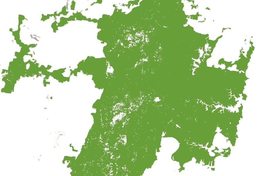
View the detailed 2024–25 canopy cover data for Greater Sydney.
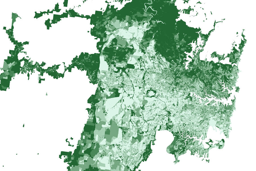
View the 2024–25 canopy cover data for Greater Sydney.
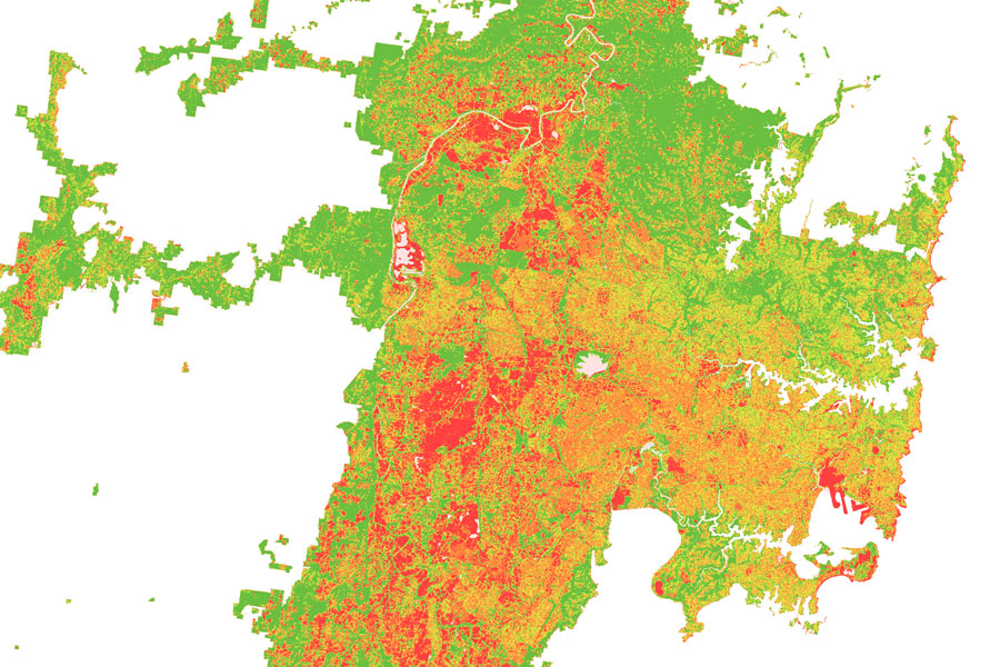
View the 2024–25 canopy access data for Greater Sydney.
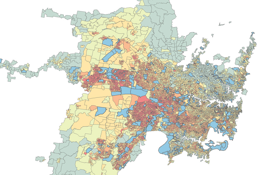
View the 2022 heat vulnerability index data for Greater Sydney.
The Green Infrastructure User Interface is a data platform and tool available to Greater Sydney councils for free, enabling users to view and analyse a range of Greater Sydney vegetation, canopy and urban heat datasets within administrative or custom boundaries.
To sign up to access the user interface, Greater Sydney councils can register their interest on the NSW Planning Portal. A limited number of licenses can also be made available to NSW Government agency employees.
These historic datasets are available at the SEED Portal:
- 2022 tree canopy data
- 2022 tree canopy to modified mesh block
- 2022 tree canopy access
- 2019 tree canopy to modified mesh block
- 2016 urban vegetation cover to modified mesh block
- 2016 urban heat island and heat vulnerability index dataset.
See the data analysis section for tips on undertaking over time data analysis.
Supporting documents
The Department has published summary statistics alongside the 2022–23 canopy cover, 2024–25 canopy cover and 2022 heat vulnerability index datasets; these statistics are available at the SEED Portal.
Over-time data analysis
Canopy data
The canopy datasets for 2024–25 and 2022–23 were captured and processed using the same methodology, allowing for a high degree of comparability. To address boundary adjustments in several LGAs and suburbs, the data is presented using both updated and original boundaries for the 2022–23 dataset. Care should be taken when comparing datasets where different boundaries are used.
It is important to note the Department’s canopy datasets for 2016, 2019 and 2022-23 were captured and processed using different methods, technologies and resolutions. Care should be taken when comparing canopy cover between datasets, especially in LGAs with a lower proportion of Metropolitan Urban Area (MUA), as some observed differences may be a result of variations in methodologies rather than actual change in canopy cover.
Heat vulnerability index
Broad comparisons can be made between the 2022–23 and 2016 HVI datasets, however, it is recommended to examine the changes in the underlying datasets and the absolute values of the heat exposure, sensitivity and adaptive capacity indicators rather than changes in HVI categories. This approach helps to explain the variations in HVI and informs effective heat mitigation strategies.
The Department’s approach to acquiring tree canopy data is a move towards best practice green infrastructure data collection and provision. The next canopy data for Greater Sydney will be acquired for the 2026–27 summer season and will be released when available. This data capture will also include the Hunter–Central Coast and Illawarra-Shoalhaven areas. Priority will continue to be placed on ensuring comparability with previous datasets.
Heat vulnerability index assessments do not need to be undertaken as regularly as canopy data acquisitions, allowing for changes in the underlying heat vulnerability factors to occur. The Department will provide information about future heat vulnerability index assessments as it becomes available.
All data acquired by the Department complies with Departmental privacy guidelines and practices.