A parkland corridor through Sydney’s inner west
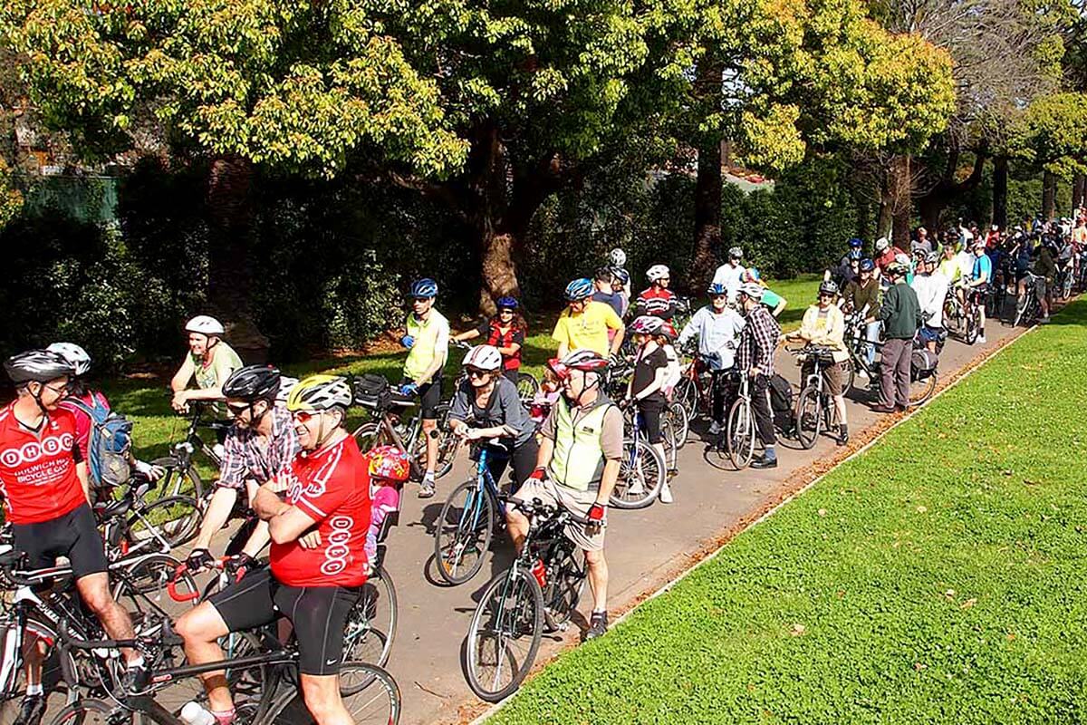
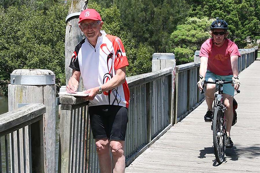
The GreenWay is a 5.8 km parkland corridor through Sydney’s inner west, shared by walkers, cyclists, and wildlife.
The vision for the GreenWay was to build an asset for collective wellbeing that would link public green spaces and restore natural environments. This idea was conceived more than 20 years ago. It took off as a community project and continues to grow.
The GreenWay is actively supported by local residents and volunteers, including bushcare groups and community-based art programs, as well as local councils, schools, and government agencies responsible for transport, planning, and urban design.
Linking urban neighbourhoods
The GreenWay links the Parramatta River at Iron Cove to the Cooks River at Earlwood through a network of footpaths, cycleways, parks, playgrounds, ovals, bushcare sites, and community facilities. It connects six urban neighbourhoods as well as light rail stops, bus stops, shopping centres, and major foreshore parks.
At a strategic planning level, the GreenWay is a regionally significant green infrastructure link that forms part of the Sydney Green Grid.
Drawing from multiple disciplines
As part of the GreenWay project, improvements to public spaces and facilities have developed alongside an evolving series of cultural and educational programs. Physical improvements include the extension of a shared cycleway and pedestrian path from Parramatta Road South to the Cooks River, planting and bush rehabilitation, the refurbishment of existing parks and public spaces, and the provision of new recreational facilities including seating and signage.
Providing environmental services
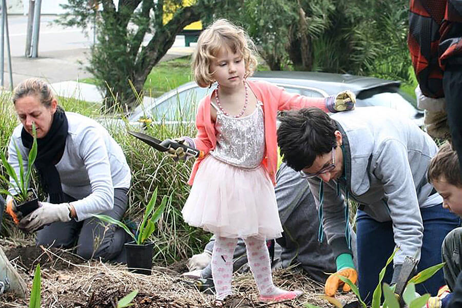
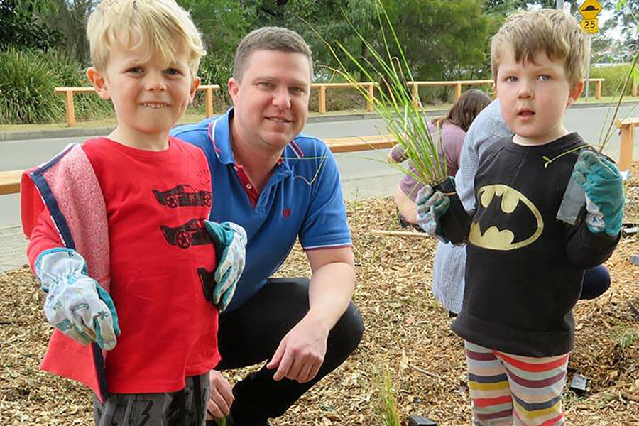
The GreenWay provides multiple environmental services, including tree canopy cover, improved habitat for threatened and endangered native animals, and reduced stormwater run-off and pollution. Currently, 16 GreenWay bushcare sites are managed by volunteers, with the support of council staff and contractors.
Leading with a community vision
The community developed the vision for a continuous 5.8-km green infrastructure link in the late 1990s, leading to the GreenWay Master Plan and Coordination Strategy, which was exhibited and adopted by the area’s local councils in 2009. This unique, continued level of community leadership and engagement is one of the principle reasons why the GreenWay vision has endured and continues to evolve.
The evolution and ongoing expansion of the project demonstrates the importance of authentic community engagement and participation in developing and maintaining green infrastructure.
Building environmental awareness
Education to promote bushcare and awareness of the local environment is an ongoing community priority. The parkland corridor has become an important sustainability research facility and outdoor classroom for primary, secondary, and tertiary students, managed by volunteers in collaboration with local school teachers, sustainability staff from local councils, and the NSW Department of Education. An arts and culture program including a GreenWay Art Exhibition is now in its 7th year.
Governing a shared asset
The Greenway peak advisory body is a steering committee comprising representatives from the local councils, the community, Friends of the GreenWay, environment groups and cycling groups.
The vision, community consultation, planning and strategies for the GreenWay are coordinated through the GreenWay Master Plan and Coordination Strategy (2009).
The GreenWay project exemplifies ‘a grassroots vision driven largely by volunteers … positioned in a unique governance niche based on social democracy principles and passionate, community-led advocacy.’
GreenWay Governance Research Project Report, Key Research Findings
Graduate School of the Environment, Macquarie University 2012
Completing the missing links
The local councils involved are working on plans to complete the missing parts of the network in consultation with government agencies and the community.
Lessons learnt
Whole-of-government projects on public land involving multiple partners must deal with many challenges:
- Each of the entities involved has had to manage their fair share of the costs and risks, and these have to be apportioned in an acceptable, equitable, and affordable way.
- Competing community desires, expectations, and needs have to be balanced, especially given the narrow width of the corridor. For example, providing a route for active travel has been the primary focus, and for some people this has been seen as taking too much priority away from other needs such as urban ecology, arts, and culture.
- Community involvement in place making is time consuming and often difficult to manage, due to conflicting perceptions and needs which take time to resolve. Maintaining a high degree of community involvement in place planning and place making has been challenging, while also accommodating the need for a complex capital works project to be “rolled out” according to plan.